
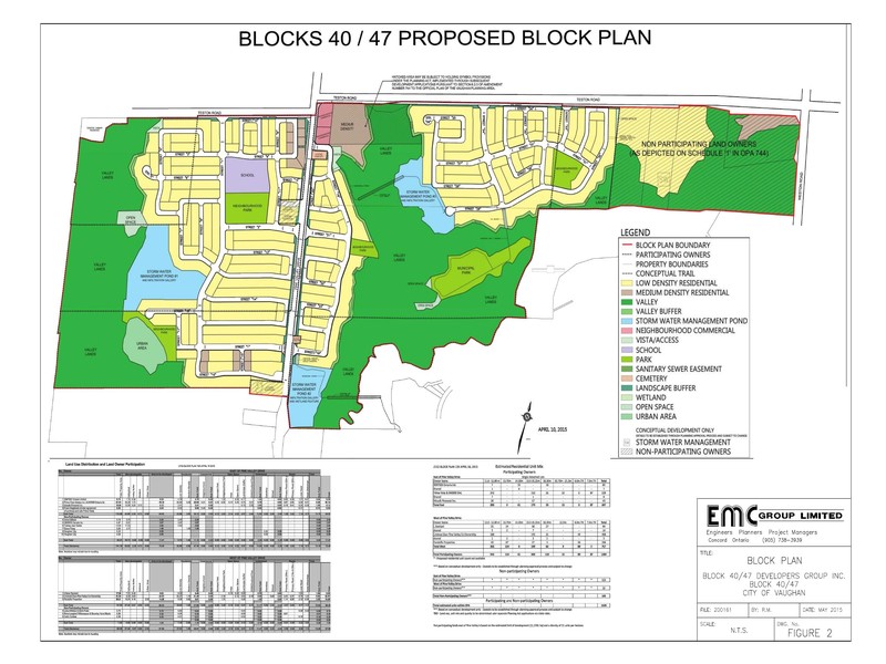
EMC Group Limited prepared the Master Environmental / Servicing Plan (ME/SP) for the Block 40/47 North lands in the City of Vaughan—one of the GTA's most significant greenfield community developments. Spanning approximately 239 hectares within the environmentally sensitive Cold Creek basin of the East Humber River subwatershed, the plan area is situated south of Teston Road, east and west of Pine Valley Drive, and west of Weston Road. The ME/SP established the foundational engineering, environmental, and servicing framework for what would become Pine Heights Estates, a prestigious community of predominantly executive homes integrated with protected valley lands, parks, schools, and commercial areas.
Project at a Glance
- Client
- Block 40/47 Developers Group Inc.
- Location
- Pine Valley Drive & Teston Road, City of Vaughan, ON
- Plan Area
- ~239 hectares (140 ha developable tableland)
- Residential Units
- ~1,384 lots + 167 townhouses
- Type
- Master Environmental Servicing Plan
- Status
- MESP Accepted — Subdivisions Advancing
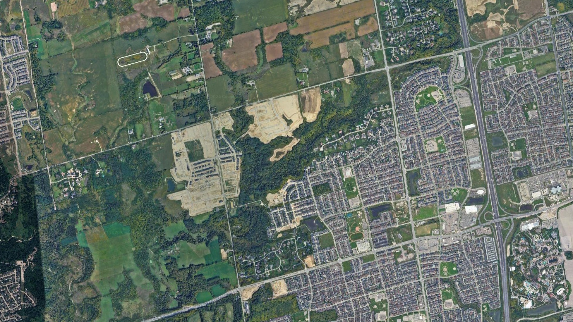
Interactive map showing the subject site with property boundary overlay. Click the map to enable scroll zoom.
A Comprehensive Engineering Undertaking
The Block 40/47 North ME/SP was one of the most complex greenfield master planning assignments in the Greater Toronto Area—navigating evolving environmental science, rigorous regulatory requirements from the Toronto and Region Conservation Authority (TRCA), and the listing of the Redside Dace as a provincially endangered species under Ontario's Endangered Species Act.
EMC Group Limited served as lead consultant for the ME/SP, responsible for stormwater management, grading, and water and wastewater servicing design. The multi-disciplinary consulting team included KLM Planning Partners (planning), Azimuth Environmental Consulting (environmental), Geospec Engineering and Soil Engineers (geotechnical and slope stability), Cole Engineering (transportation), Valcoustics Canada (acoustics), Schaeffer & Associates (water supply), AquaLogic (meander belt analysis), and Greenland Consulting Engineers (erosion and geomorphology).
Developing Within an Ecologically Sensitive Watershed
The subject lands are traversed by three branches of the Cold Creek—a tributary of the East Humber River—which convey permanent flow and support a diverse fish community of 45 documented species, including three trout species and the provincially Endangered Redside Dace. Provincially significant wetlands within the East Humber River Wetland Complex were staked by the Ministry of Natural Resources in 2013 and encompass over 15 hectares within the valley system. Valleylands comprising more than 30% of the subject lands are heavily forested, with slopes descending steeply from the agricultural tablelands.
Development limits were established through extensive consultation with the TRCA, requiring minimum 30-metre setbacks from watercourses and provincially significant wetlands, geotechnically stable top-of-slope limits, regional flood line setbacks, and 10-metre property line buffers from staked valley feature limits. The ME/SP's conceptual grading design preserved the natural landform by maintaining existing drainage patterns and matching grades along the top-of-bank.
Stormwater Management Strategy
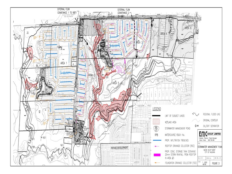
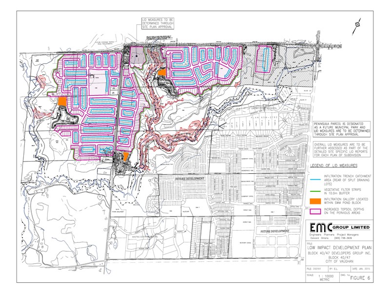
The stormwater management plan addressed some of the most rigorous environmental standards in the GTA. Three stormwater management ponds were designed to control post-development peak flows to TRCA Unit Flow Rates for all storms up to and including the 100-year event. The strategy implemented a comprehensive treatment train approach incorporating lot-level controls (rear yard infiltration trenches, increased topsoil depth, roof leader discharge to pervious areas), conveyance controls (foundation drain and roof drain collector systems, grassed swales), and end-of-pipe facilities (wet ponds with infiltration galleries).
A feature-based water balance analysis—conducted in accordance with TRCA, City of Vaughan, and MNR criteria—evaluated the impact of development on each pre-development drainage feature, including headwater drainage features and provincially significant wetlands. Where stormwater diversion created runoff volume deficits, foundation drainage collection and rooftop collection systems were engineered to maintain pre-development hydroperiods and protect the ecological functions of downstream natural features.
Infiltration galleries at each stormwater management facility outlet provided additional runoff reduction, extended erosion protection, and thermal cooling of discharged stormwater—critical for protecting the cold-water fishery habitat and Redside Dace populations in the receiving watercourses.
Municipal Servicing
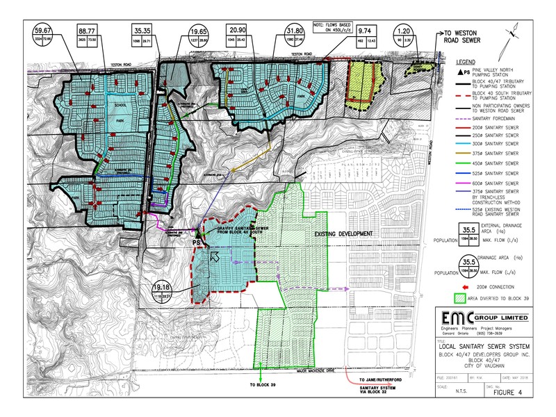
The sanitary servicing strategy required the construction of the Pine Valley North (PVN) Pumping Station to overcome the constraint of the Cold Creek valley lands, which prevented gravity flow to the eventual outlet in Block 40 South. Two pedestrian/utility bridges were designed to cross the valley—one centrally and one at the southerly section of Block 40 North—carrying sanitary sewers, watermains, and pedestrian walkways with minimal disturbance to the forested valley corridor.
The water distribution system connected to a trunk watermain extended along Teston Road from its terminus at Weston Road. The local distribution network, ranging from 150mm to 400mm diameter, included looped crossings via the pedestrian bridges to maintain pressure and flow within Water Pressure District 7.
From Master Plan to Emerging Community
The proposed development on participating owners' lands comprises approximately 1,384 residential lots—the majority single-family detached dwellings with frontages from 11.8 to 21.3 metres—along with 167 townhouse units, a 2.4-hectare elementary school block, community parks totalling over 5.5 hectares, a 3-hectare municipal park on the Peninsula Parcel, and commercial areas at the Teston Road and Pine Valley Drive intersection.
With the ME/SP completed and accepted, multiple landowners within the block—including Prima Vista Estates, Mosaik Pinewest, Lindvest Zzen, and other members of the Block 40/47 Developers Group—have been advancing their individual plans of subdivision and site plans through the approvals pipeline. The community is taking shape with a mix of housing forms, neighbourhood parks, pedestrian walkways, and dedicated open spaces connected to the protected valley lands and greenway corridors of the Humber River watershed.
Planning a Large-Scale Land Development?
From master environmental servicing plans and block plan studies to individual subdivision approvals, EMC Group delivers the engineering and environmental expertise to move complex greenfield developments from concept to construction.